Laverstoke via Pot Bottom (Ref: 62)
Start point
51.234541°N -1.29678°E or UK OS Grid Ref SU4912348608, which is approximately 3.0 Km (1.9 miles) from Bell Street Car Park by road
Click HERE for a route courtesy of Google
The walk
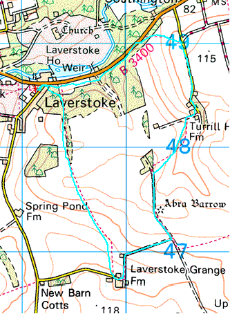
Distance: 6.9 Km (4.3 miles)
The route is indicated by the pale blue line: ![]() Start/finish is indicated by the small star:
Start/finish is indicated by the small star: ![]() which can be hard to spot, but must lie somewhere on the pale blue line.
which can be hard to spot, but must lie somewhere on the pale blue line.
The club has walked this way, so far as records exist, on the following occasions:
| Date | Leader | Attendance |
|---|---|---|
17/06/2009 |
SR |
6 |
We don't have any pictures of this walk yet. If you have some you would like to see here please send them to me - secretary@whitchurchramblers.org.uk