St Mary Bourne via Middle Wyke (Ref: 26)
Start point
51.25036°N -1.3979183°E or UK OS Grid Ref SU4211850304, which is approximately 6.0 Km (3.7 miles) from Bell Street Car Park by road
Click HERE for a route courtesy of Google
The walk
Distance: 6.6 Km (4.1 miles)
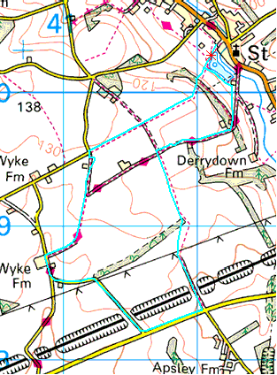
The route is indicated by the pale blue line: ![]() Start/finish is indicated by the small star:
Start/finish is indicated by the small star: ![]() which can be hard to spot, but must lie somewhere on the pale blue line.
which can be hard to spot, but must lie somewhere on the pale blue line.
The club has walked this way, so far as records exist, on the following occasions:
| Date | Leader | Attendance |
|---|---|---|
21/05/2008 |
RC |
33 |
20/07/2005 |
BB |
32 |
2002 |
Probably BB |
Not recorded |
2001 |
Probably BB |
Not recorded |
1999 |
Probably BB |
Not recorded |
1996 |
Probably BB |
Not recorded |
1995 |
Probably BB |
Not recorded |
Whilst rambling, someone took some PICTURES.